
SAR-Based Rice Health Monitoring System
A full-stack platform for cloud-free rice crop health monitoring across Punjab's kharif season - using Sentinel-1 SAR imagery to classify fields as Stressed, Moderate, or Healthy in 15-day windows, with Random Forest, XGBoost, and MLP models validated at 87.5% accuracy.
Key Outcome
87.5% classification accuracy
Cloud-free rice crop health mapped across Punjab's entire monsoon growing season at 15-day intervals.
Rice farming in Punjab runs through monsoon season, which blinds optical satellites (Landsat, Sentinel-2) for months - leaving farmers, insurers, and the Agriculture Department without reliable crop health data precisely when they need it most.
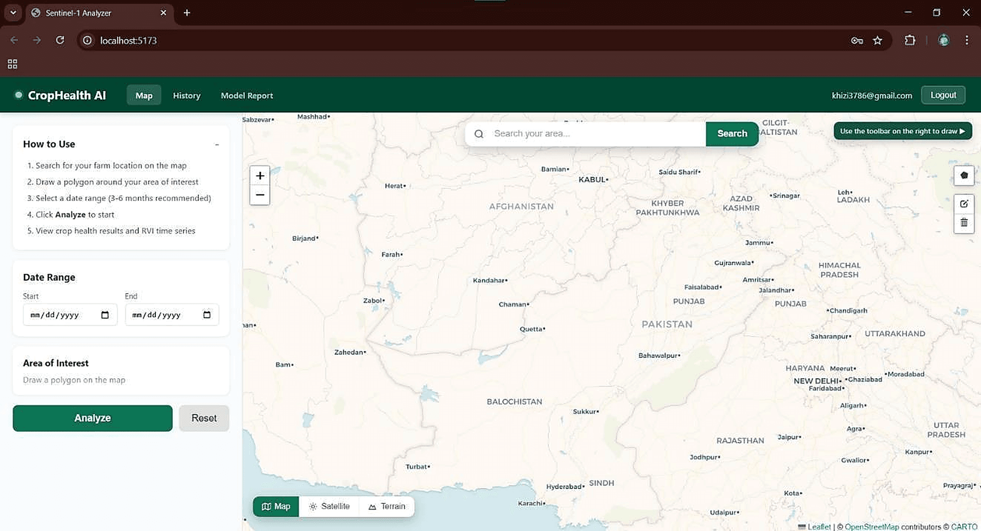
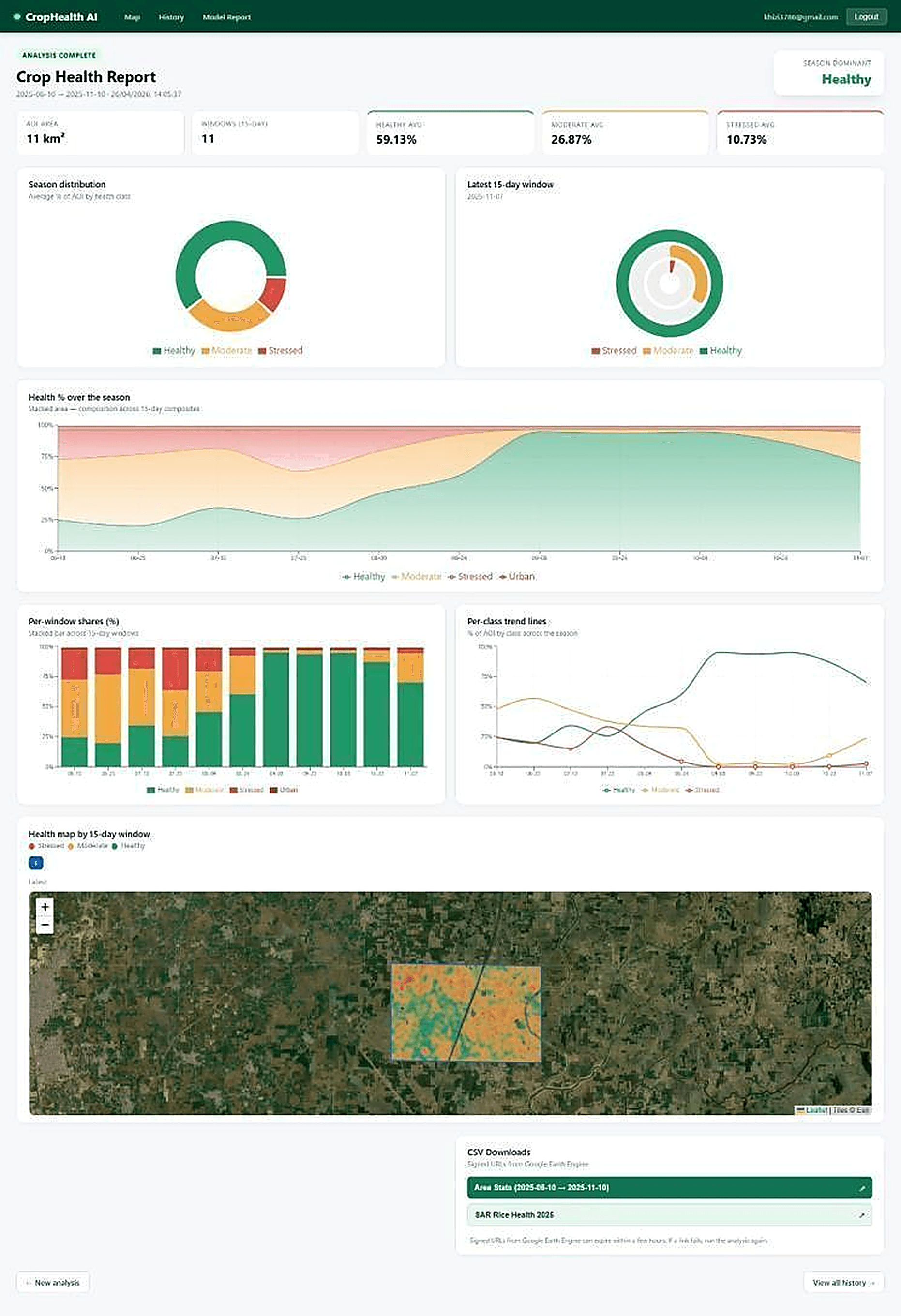
Built a web platform using cloud-penetrating Sentinel-1 SAR (VV/VH backscatter) to compute 15-day Radar Vegetation Index composites. Users draw an Area of Interest on an interactive Leaflet map and receive temporal health charts, classified health maps, and downloadable CSVs. Three ML models - Random Forest, XGBoost, MLP - were trained on a 30,000-sample multi-year SAR dataset, with XGBoost reaching 87.5% accuracy.
Key Features
Interactive AOI polygon drawing on a Leaflet map to define the rice field area
Cloud-free 15-day SAR composites from Sentinel-1 VV/VH backscatter via Google Earth Engine
Automated rice masking using Sentinel-2 NDVI + ESA WorldCover to exclude non-agricultural land
Three-class health classification: Stressed / Moderate / Healthy using percentile-based labelling
ML model benchmarking: Random Forest, XGBoost (87.5% accuracy), and MLP across 24 SAR features
Temporal health charts, season distribution donuts, and health map overlays in real time
One-click CSV export via signed Google Earth Engine download URLs
Firebase-backed analysis history per logged-in user
Technology Stack
Project Visuals


Interested in a similar project?
Tell us your requirements and we will respond within one business day.